


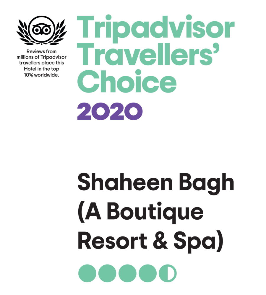
Shaheen Bagh - A Luxury boutique hotel and resort in Dehradun
Welcome To Our Resort In Dehradun - Jamniwala, Sigli, Dehradun - 248003, Uttarakhand

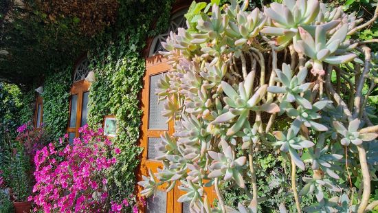
The property homes about 10,000 different plant varieties to cater to an elegant yet calming surrounding. This stunning resort in Dehradun is guilty of serving fresh produces and organic food, along with their very own in-house milk and milk products. Bejewelled with a variety of vibrant and radiant flowers that fill up the atmosphere with an alluring fragrance, this splendid and luxurious Dehradun resort provides a gateway to nature's lap. This Dehradun resort with pool is also a biodiversity spot, a bird lover's paradise with several species of birds taking shelter here. Shaheen Bagh serves as an ideal site to indulge in bird watching.
CELEBRATE THE ART BEHIND NATURE AT NATURE'S PRIDE, SHAHEEN BAGH
IDEAL ROMANTIC GETAWAY FOR COUPLES AND OTHER TRAVELLERS
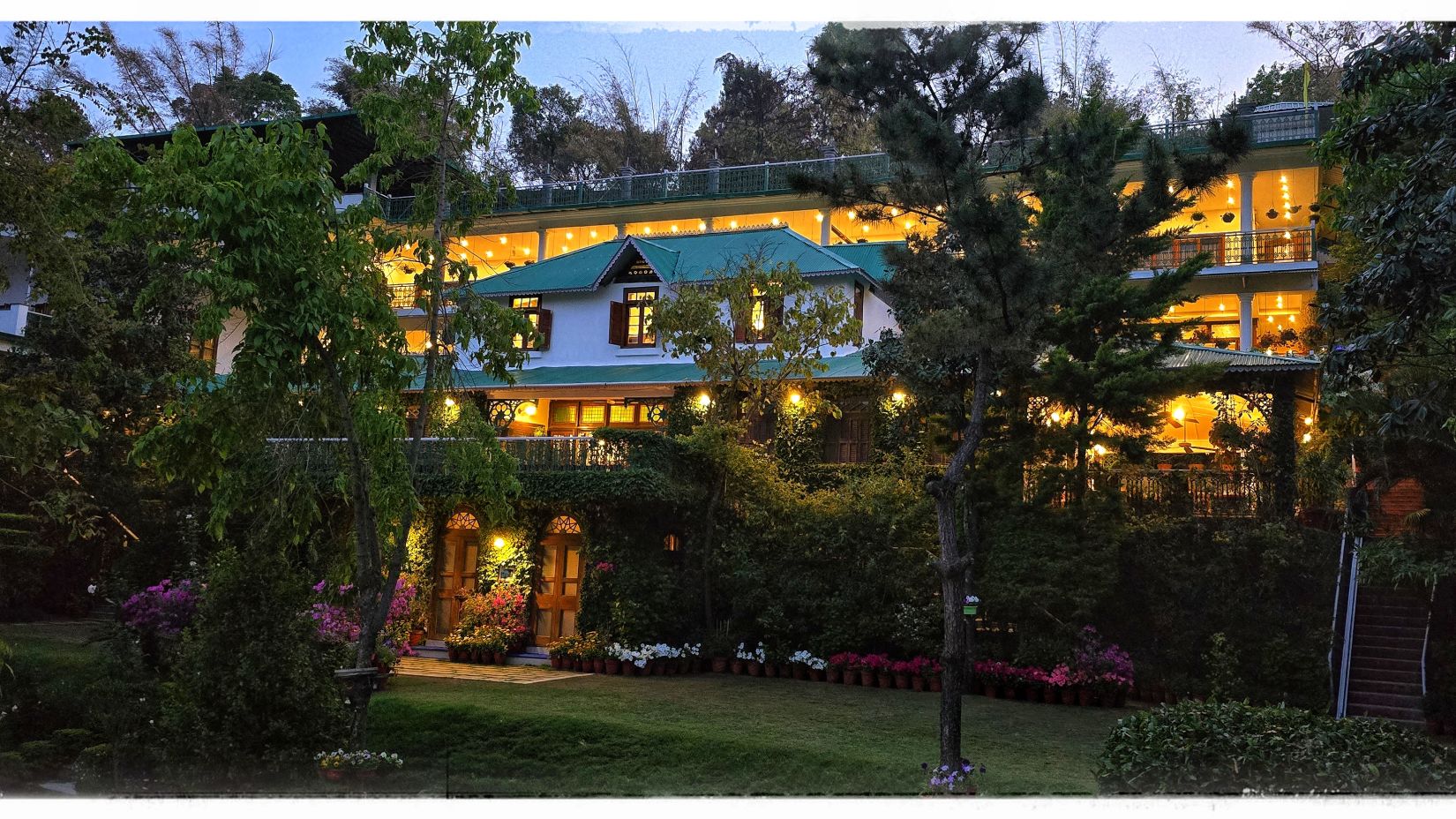
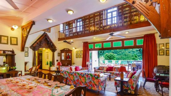
As the warmth of the sun shines over Dehradun,the cool location of Shaheen Bagh Hotel & Resort gives its visitors a perfect escape from the heat to enjoy the tranquillizing nature of the city in all seasons. Shaheen Bagh is a gorgeous boutique spa & resort in Dehradun, located just 30 mins away from Dehradun railway station and is in close proximity to the Tons river. Maintained by Mr Arun & Mrs Sandhya Gupta, this bungalow resembles the colonial architecture of the bygone era. If you're looking for a tranquil vacation experience perched on top of a hill and far away from the hustle and bustle of city life, you have arrived!
Indulge in the aura touched by some of the frontrunners of the Tinseltown, this glamorous boutique hotel & resort in Dehradun is bound to leave you awestruck. Some of the giants from the reel world like Shahid Kapoor, Shraddha Kapoor, Rajnikant Sir, Katrina Kaif, as well as Hollywood fame Shay Mitchell have all blessed the grounds of this chic resort!
RED CARPET ROLLS IN SHAHEEN BAGH
| A Slice of Heaven's Garden |
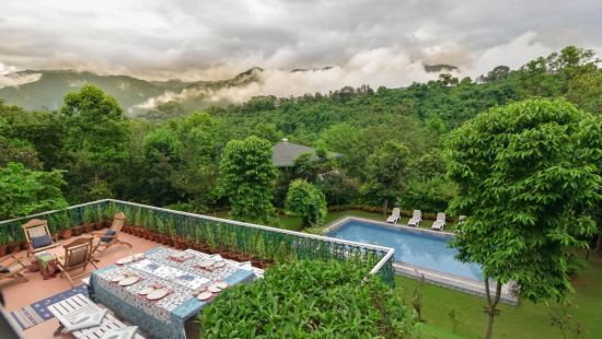
An ode to the beauty, flora, fauna and natural luxuries of the mighty Shivaliks, Shaheen Bagh - A Luxury Boutique Resort & Spa in Dehradun, is an award-winning luxury resort set in the picturesque Doon Valley. Sprawled on a 7-acre estate with fruit orchards, exotic plants and trees along with landscaped gardens, the resort is home to many species of Uttarakhand birds. 5 hours away from the hustle of Delhi, Shaheen Bagh offers a luxe nest away from the cacophonic cities with an abundance of nature, natural springs, magnificent hill views, a graceful garden, secret hiking trails, fresh air and positive vibes for an enriching vacation to harmonize natural energies and restore the balance of body, mind and heart. Indulge the luxury-driven wanderlust in you to enjoy the delights of nature at Shaheen Bagh boutique hotel & resort!


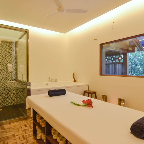
Spa
Experience wholesome mental and physical health at our Ayurvedic Sparsh spa in Dehradun. Embrace a therapeutic blissful stay!

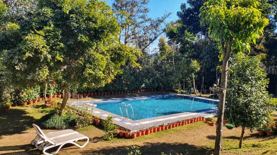
Swimming Pool
Dive in and rejuvenate yourself, spend quality time with loved ones here and cherish your stay at our hotel.

Activities
Break the monotony of your life with our fishing activities or take your loved ones out for our wine classes. .

Lonely Planet : Exploring Romance
Nestled on a 7-acre estate, Shaheen Bagh presents itself as the perfect, romantic abode. Located on the banks of River Tons, the vintage-like resort surrounds itself with calm greeneries, orchards, and gardens!
Read More >
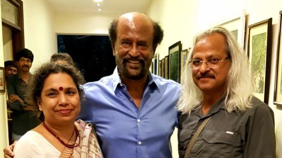
List of Celebrities at Shaheen Bagh
Over the years, Shaheen Bagh has opened its doors to a stunning line of celebrities and popular figures. From cricketers to actors, the resort has been a humble home to several well-known personalities!
Read More >

The Times of Doon
The buzz around the superstar, Luke Kenny's vacation at Shaheen Bagh gave the resort in Dehradun its rightful spot in media. After completing his upcoming film's shoot, he is now resting at the Bagh!
Read More >

Bollywood's Favoured Spot
Becoming increasingly popular amid the Tinseltown, Shaheen Bagh once again found itself on Bollywood's radar as popular films with famous casts continue to shoot gleefully at the resort, soaking in the beauty and serenity.
Read More >

The Mighty Shaheen Falcon!
Do you know that Guru Govind Singh is also known as the ‘Chittaye baaja wala', which means ‘keeper of the white falcon'? The falcon that the tenth Sikh Guru would carry perched on his hand is the Shaheen Baaj.
Read More >
 |  |

- Around 20 mins to Tapkeshwar Temple
- Gaming zone for kids and Spa facilities for everyone
- 7-acre estate with fruit orchards, exotic plants, and landscaped gardens
- Different activities like wine classes, fishing, or trekking
- Gardens in Five levels
- Gardens on Five Levels
- Dining Area
- Gaming zone for kids
- Bonfire in winters ( on chargeable basis)
- Fireplace is in the common area
- Cab on call
- Yoga is Complimentary (Need to inform us in advance)
- Wellness Centre - Spa steam & Jacuzzi
- Swimming Pool
- Gym
- Acoustic Room
- Chair Lifts for Elders